
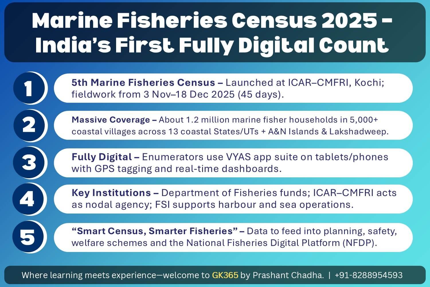
“Smart Census, Smarter Fisheries.” — Official slogan of India’s first fully digital Marine Fisheries Census
India launched its 5th Marine Fisheries Census on 31 October–1 November 2025 at ICAR–CMFRI, Kochi. For the first time in history, this census runs entirely on digital tools — marking a watershed moment in how India counts and tracks its marine fishing communities.
The 45-day field exercise (3 November – 18 December 2025) will cover approximately 1.2 million marine fisher households across more than 5,000 coastal villages and habitations. Enumerators armed with tablets and smartphones will use the VYAS app suite for real-time data capture, while drones will assist in counting fishing vessels at major harbours.
🌊 Why This Census Matters in 2025
Marine fisheries face mounting pressures from extreme weather events, changing markets, and rising fuel costs. Policy teams urgently need detailed data on people, boats, gear, harbours, and supply chains to design effective interventions.
Earlier census rounds provided valuable information, but final tables arrived after significant delays due to paper-based enumeration and manual data entry. The 2025 round addresses this by moving to digital capture from day one, promising faster aggregation and geo-referenced outputs for state dashboards and national planning.
Think of this census like upgrading from handwritten ledgers to a GPS-enabled inventory system. Instead of waiting months for paper forms to be collected, entered, and verified, supervisors can now see real-time maps showing which villages have been covered and which need attention — all from their phones.
📱 The VYAS App Suite: Digital Backbone
The census runs on the VYAS suite of Android applications, each serving a distinct function in the enumeration workflow:
- VYAS–NAV: Validates lists of villages, harbours, and landing centres before household work begins
- VYAS–BHARAT: Runs the main household and infrastructure questionnaires with GPS tagging
- VYAS–SUTRA: Supports live supervision, field control, and real-time dashboard monitoring
| App | Full Form / Purpose | Primary Users |
|---|---|---|
| VYAS–NAV | Village/harbour list validation | District teams |
| VYAS–BHARAT | Household & infrastructure surveys | Enumerators |
| VYAS–SUTRA | Live supervision & field control | Supervisors |
Memory Aid: Think “NAV-BHARAT-SUTRA” — Navigate first (validate villages), then survey Bharat (households), finally Supervise with SUTRA (dashboards).
🚁 Drone-Assisted Craft Counts: A First for India

For the first time at national scale, drones will support craft counts during trawl ban periods and harbour lay-ups. Aerial images of jetties and berths provide neutral baselines for vessel numbers that can be cross-verified with ground reports.
Selected ports for drone operations include Visakhapatnam, Kakinada, Tuticorin, Mangaluru, and Beypore. Field teams match drone outputs with on-ground data to ensure accuracy. All drone flights follow DGCA regulations and focus on vessels in open jetties, not individuals.
Drones provide an independent verification layer that reduces the risk of under- or over-counting vessels. In future census rounds, this technology could expand to cover all major fishing harbours, creating time-series data on fleet capacity changes.
📋 What Data Will Be Collected
The census captures a comprehensive range of information across four major categories:
| Category | Data Points Collected |
|---|---|
| Household Profile | Family size, age pattern, education, disability status, insurance, debt, credit access, income sources |
| Work & Welfare | Registration status, scheme coverage, training, safety gear, labour patterns (sea & shore) |
| Craft & Gear | Boat type, length, engine power, gear categories, ownership patterns (owned/joint/hired) |
| Infrastructure | Harbours, landing centres, ice plants, cold storage, road connectivity |
Don’t confuse: This is a Marine Fisheries Census — it covers only coastal/sea fishing. Inland fisheries (rivers, lakes, ponds) are enumerated separately. The 1.2 million households figure refers exclusively to marine fisher families.
🎯 Use Cases for States and Fishers
The census data will power multiple practical applications:
- Targeting Benefits: Clean household lists help States run PM-Matsya Sampada Yojana with less duplication, cutting leakages and speeding payments
- Harbour Planning: Counts of ice plants, berths, and landing centre throughput inform investments and queue management
- Climate Risk & Safety: Geo-tagged settlements and boat lists improve storm warnings, evacuation planning, and rescue operations
- Trade & Compliance: Better craft and gear data supports science-based fisheries management and helps exporters meet international documentation requirements (IOTC rules, vessel tracking)
🔗 National Fisheries Digital Platform (NFDP)
During the launch, the Minister urged all marine fishers and fish workers to register on the National Fisheries Digital Platform (NFDP). This platform:
- Brings scheme enrolment, permits, and services into a single portal
- Integrates with PM-Matsya Sampada Yojana and related systems
- Gains accuracy when user profiles link to verified census households
The goal is to create a unified digital identity for every marine fisher, enabling seamless access to government schemes and services through one authenticated platform.
Key Link: Census household verification + NFDP registration = faster, leakage-free delivery of fisheries welfare schemes.
🏛️ Institutions and Funding
The institutional framework for the 2025 census involves clear role divisions:
- Funding: Department of Fisheries, Government of India
- Nodal Agency: ICAR–Central Marine Fisheries Research Institute (CMFRI)
- Field Support: Fishery Survey of India (FSI)
- Geographic Coverage: All 13 coastal States and Union Territories, plus Andaman & Nicobar Islands and Lakshadweep
CMFRI conducted pre-census workshops with state departments to update village lists and train staff, reducing frame errors from boundary changes or new hamlets near harbours.
Click to flip • Master key facts
For GDPI, Essay Writing & Critical Analysis
5 questions • Instant feedback
The 5th Marine Fisheries Census was launched on 31 October – 1 November 2025 at ICAR–CMFRI, Kochi. Fieldwork runs from 3 November to 18 December 2025.
ICAR–CMFRI (Central Marine Fisheries Research Institute) is the nodal agency, while Fishery Survey of India provides field support. Funding comes from the Department of Fisheries.
The VYAS suite consists of three apps: VYAS–NAV (village validation), VYAS–BHARAT (household surveys), and VYAS–SUTRA (live supervision).
The census covers approximately 1.2 million marine fisher households across 13 coastal States and Union Territories, plus Andaman & Nicobar Islands and Lakshadweep.
The National Fisheries Digital Platform (NFDP) is the single-portal platform where marine fishers can register for scheme enrolment, permits, and services.